Equipment commonly used for surveying

3 Must-Have Tools for Your Next Survey Job
The history of surveying dates back to the 15
th century when Egyptians would measure and divide property for tax purposes. This is still one of the most common applications of surveying, but the tools used today are far more precise. Indeed,
survey instruments represent some of the most advanced technology, and surveyors can rely on these tools to record accurate measurements and data from survey sites. Learn more about three of the most essential
survey tools commonly used in the field.
1. Theodolite
A theodolite is an essential piece of
survey equipment for any professional in the field. Though it was invented in 1787, it is still an important tool for many surveyors. This tool is typically used to measure angles — especially when conducting topographic surveys — and it’s particularly useful thanks to its versatility.
You can use it in either a vertical or horizontal plane, and its measurements are notoriously accurate. Some surveyors may consider a theodolite to be obsolete, though, due to the advent of new tools that can produce the same measurements. A total station, for example, can also measure angles in addition to other functions. Still, every surveyor should have a theodolite and understand how to use it.
2. Total Station
A total station is another important tool that every surveyor must be familiar with. This tool has replaced theodolites in many modern surveying applications, and it offers a multifaceted list of functions to users. It can capture angular measurements with its built-in theodolite, and it can also store the captured data with a microprocessor. Furthermore, it can measure slope distances, which makes it useful for surveying sites such as mines and quarries.
The ultimate benefit of a total station, though, is its method of measurement. This tool typically uses an infrared carrier signal or a microwave. Both of these are transmitted from the optical path within the total station. This reduces the overall burden of manual measurement that a surveyor must complete, and it also ensures that the signal is stable throughout its transmission.
3. Transit Level
Transit levels might be the most vital tool of all for modern surveying. This tool is incredibly simple, but it’s uniquely equipped to capture a variety of different measurements. Surveyors can use a transit level to measure points and horizontal lines down to the exact millimeter. The tool relies on a spirit level to achieve remarkably accurate readings.
This level of precision makes transit levels perfect for tracking movement over time. Transit levels are also ideal for measuring structures such as dams and buildings because it can detect any slight movement that might occur. This helps surveyors identify potential migration problems and other issues.
Use the Right Survey Tools for Accuracy Every Time
Surveyors can’t compromise on accuracy when it comes to the tools they use. That’s why theodolites, total stations, and transit levels are essential
survey tools for every professional surveyor. Find the
instruments and equipment you need for your next job at Engineer Supply. We carry the top brands and offer unbeatable prices. Call us at (800) 591-8907 if you any have questions.

Frequently Asked Questions
What are the most commonly used survey tools?
Different types of surveying demand different kinds of tools, so the answer to this question depends on what field of surveying you’re considering. Generally, though, theodolites, total stations, and transit levels are three of the most commonly used tools. This is because of their ability to generate many different measurements and their precision and reliability.
What are the three most common types of surveying?
Surveyors will typically complete one of three types of surveys — a boundary survey, a topographic survey, or a location survey. Boundary surveys are used to identify the boundary lines and corners of a property. Topographic surveys are used to identify the surface features of a property. Location surveys are used to pinpoint the exact coordinates of a property.
How many survey tools does a surveyor need for a job?
There are many survey tools that surveyors can use during a job, but there is no specific number that is required. Some jobs will require the use of several tools while other jobs may only need a single tool.
What is a theodolite used for?
A theodolite is used to measure vertical and horizontal angles. This allows for more accurate triangulation.
What is the most accurate kind of survey tool?
Accuracy is of the utmost importance when surveying, so all survey tools are designed to be precise. Some survey tools such as total stations feature more advanced technology, though, that may produce more accurate results.
Best Survey Equipment
Magnetic Locators
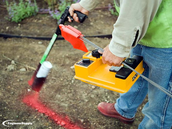
If you’re looking for lot lines in an urban or suburban area, there are likely already surveying stakes in the corners of every lot. It’s important to mark your own lines to verify accuracy, but a convenient place to start is with the existing surveying stakes.
A magnetic locator helps you find these stakes. Simply turn on the locator and work your way around the area where a stake is likely buried. These locators detect magnetic signals from buried metal items, so they’ll find a number of other items in addition to surveying stakes. Once you find a metallic object, dig it out to verify it’s a stake.
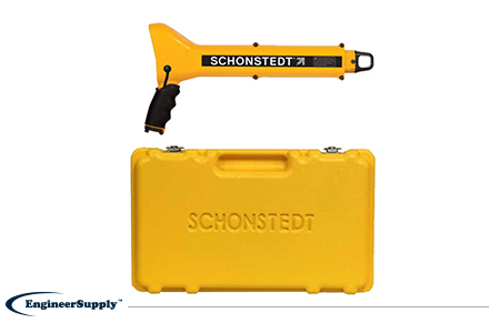
One of the most convenient, practical locators is the
Schonstedt GA-52Cx. This basic model is highly reliable, but doesn’t have all the programmable settings of other locators. Use it to find metallic objects with highly sensitive location technology and a rugged, weather-resistant control panel.
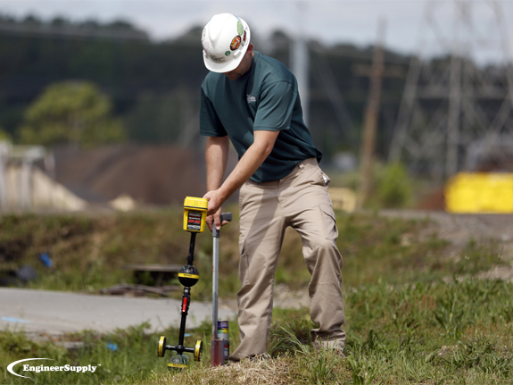
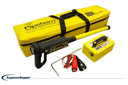
The
Pipehorn 800HL detector is one of the most versatile options for locating buried objects. This dual-frequency detector works as both a pipe and cable locator. Connect the transmitter to a buried line to follow an electric, water or gas line buried in the ground. Once you locate and flag these buried lines, switch modes to sweep for unmarked utilities with the tracer wire and tape.
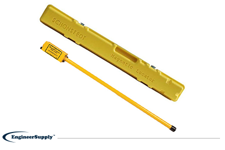
A more portable, high-tech Schonstedt magnetic locator option is the
GA-92XTd. This model uses a compact design and versatile control panel for both audio and visual indication. The small size doesn’t mean less power, so you can use this locator to find ferrous items buried up to 16 feet underground. Pack it away in the small, durable case to keep in your truck or toolbag wherever you work.